Showing posts with label CBD. Show all posts

Friday, 9 October 2015

The CBD - From a Distance


The city is on the south-side of the harbour. Greenwich (gren-ich) Point is on the north-side of the harbour. We are looking south-east. It is about 9am last Monday, a Public Holiday here in New South Wales.

Greenwich Point baths are new to me. They are a small, fenced, harbour pool; pay for entry. Parking is not easy to come by. Access is steep. It is a delight, and the views are to die for.

They have a "Nippers" programme which starts on 1st November, so I am assured we will be back.

A note on the first image. There is a forested area immediately before the high-rise of the CBD. This is Goat Island.


Friday, 6 January 2012

Skywatch - Geography maketh the man

We are an open, welcoming, friendly bunch, we who live in this city by the sea. And how would we be otherwise, with scenes like this at our doorstep. Not for us the continuous pall of grey mist, and early close to days which greet others. I wonder if we acknowledge it enough: our debt to this drowned valley.

Elizabeth Farrelly, writing in the SMH this morning argued:
A good harbour, like a good city, relies on connectivity. The water is great. In Sydney's case, the topography is also great. That's nature.

But what makes nature into a great harbour is culture. It's the transitional fringe, the incremental embroidery of wharfs, slipways, seawalls, steps, cafes, platforms, boathouses, chandleries, shipwrights, moorings and (if you really must) marinas that make a harbour. Sydney Harbour has a grand tradition of this stuff - working, industrial harbour furniture much of it, but also the canvas dinghies, packet boats, watermen's wherries, tugs and fishers and coal lighters and wild 18-footers and container ships.

Both photos are of Watson's Bay: looking from it to the city; looking down into, and across it.

This is my contribution to the Skywatch Community.

Friday, 16 December 2011

Reflecting the past

Looking down Essex Street from its intersection with Gloucester Street. The plate glass building, hosting the reflection, is on George Street, the main thoroughfare of our city. This is all down fairly close to the harbour.

Sunday, 11 December 2011

Colour my world

Christmas is only two weeks today. It seems to be winding up very slowly this year. To me, at any rate.

Tuesday, 6 December 2011

At the going down of the sun

The city from 'Doyles on the Beach' at Watson's Bay.
Time lapse: 7:39pm, 7:45pm, 7:47pm.

Monday, 28 November 2011

Oh for a lane, an alley, a row


This is the sort of streetscape that sets my curiosity afire. I don't give you tuppence for the gloss of the Pitt Street Mall, with its concrete and glass and designer stores, tickling brass farthings. Give me an alley, with a rusty fire-escape draped with potato sacks anytime.

Saturday, 26 November 2011

Off-cool


And yet, some of York Street can be acceptable, if you know where to look, and squint just the right way. You see, York St is off - I cannot say 'off Broadway' because we actually DO have a Broadway, and unfortunately, York St is nowhere near Broadway. I think it boils down to, York St being 'off-cool'. Our main street is George Street, and York is one to the west of that. How last-year can a street get!

Friday, 25 November 2011

Man in phone booth


This is a study in depth. There is a tree. Behind that is a facade. Within the facade are the internal lights. Imprinted on that is the reflection of the building across the road, in front of which I am standing.

Cities can be glamorous places. But much of a city is simply tawdry. York Street borders on tawdry on occasion.

Thursday, 24 November 2011

Concrete geometry


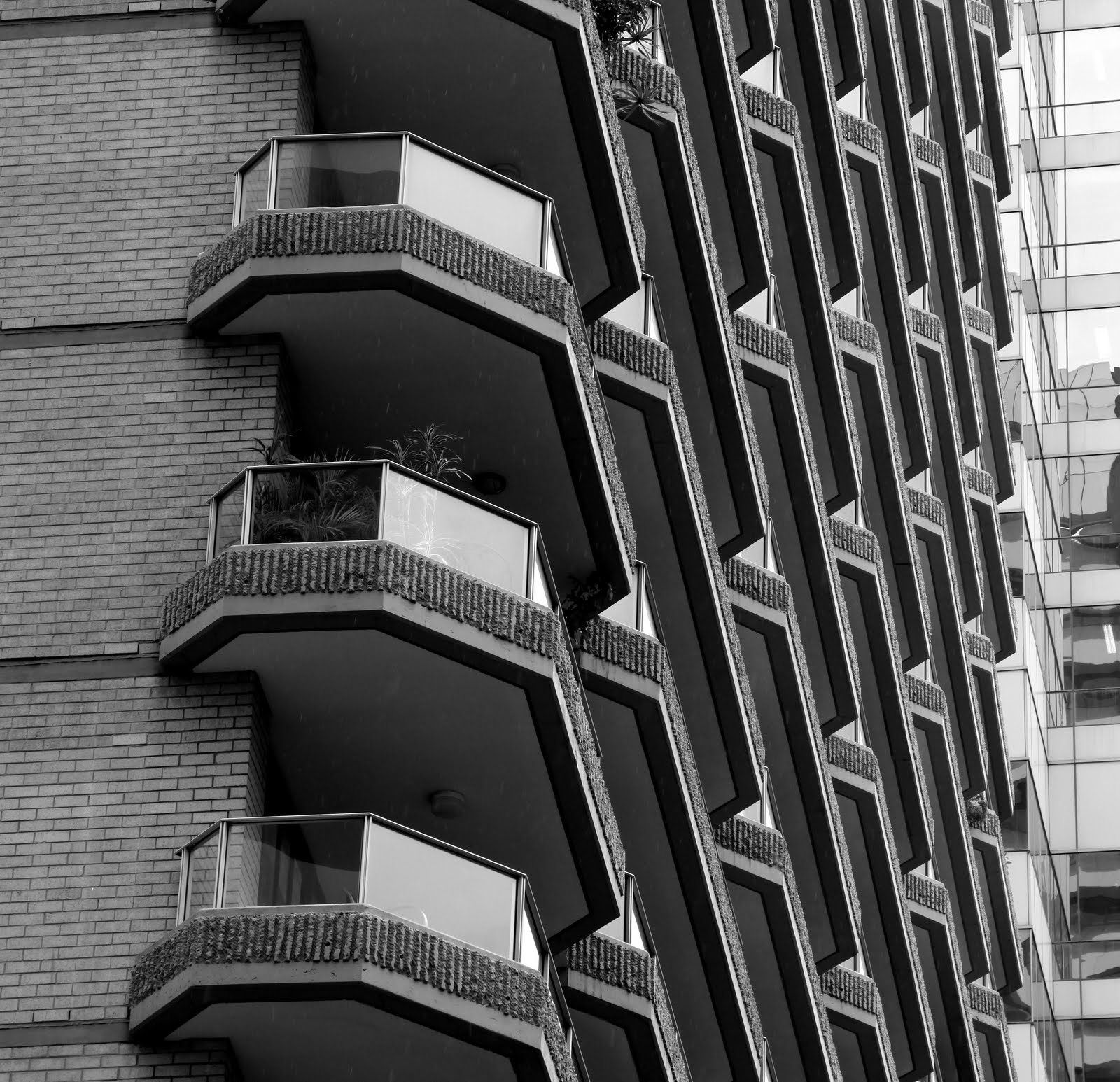
The facade of a high-rise apartment block in Haymarket, which is an inner city suburb.

Tuesday, 13 September 2011

Cycling against the tide


Here is a view of each section of College Street in the inner city. The top shows the College Street cycleway from Whitlam Square to Park Street. The lower shows the same cycle way from Park to Macquarie Street. This is the cycleway that the City of Sydney decided to rename the 'Cadel Evans Cycleway' at the end of July.

Cycleways cop a bashing in the popular media at the moment. These shots will simply reinforce the argument that they are under-utilised white-elephants. However, I am in favour of them. But, I no longer drive, and am no longer welded to the assumptions and prejudices of the motoring public. I have to go everywhere by public transport or shanks' pony. So it stands to reason that I am in favour of cycleways. I am also in favour of the return of trams to the inner city. But trams were crucified by the motoring organisations of the 1950s.

Nothing has changed 60 years later.

Friday, 12 August 2011

Bird's eye view


Market Street is one-way crossing the CBD from East to West. It runs from Hyde Park North to Darling Harbour. Half-way along Market street in the block between George & York Streets stands the QVB which was built in 1888. Prior to this, there was a market on the site. Hence, the name.


Across Market Street in the photograph above, can you discern the glassed pedestrain walkway at the 1st floor level? I stood in this glassed enclosure to take a series of images up and down Market Street early on a Sunday morning.

In the photo on the LHS, I am facing west, toward Darling Harbour which is over the rise. See that bloke in the centre of the road? Where he is standing used to be the swamp wherefrom the Tank Stream sprang. The TS is the reason the early settlers established Sydney where it is. But within 80 years we had polluted the stream and now it is totally underground. In the photo on the RHS, I am facing east, toward Hyde Park. The neon light is an advertisement in the St James subway station which was dug into the park in 1926. All images should enlarge.

Tuesday, 19 July 2011

The devil is in the detail


Here I go, leading you off down the garden path to 'geekdom' again. I have excelled myself this time ... hee hee hee!

You're dying to know what that daft little metal thingamejig is, aren't you? I can just sense the excitement bubbling to the surface ...

Once long ago, when politicians were even more daft than they are now, the city of Sydney did away with trams. After a century, and with one of the most extensive tramway systems in the world ... poof ... overnight ...

But, if you look really, really hard, you can find little bits they forgot.


The old photograph was taken in 1960 and shows a tram going down the hill from Kings Cross and just before Rushcutters Bay park. See all those cables that supply the electricity to power the trams? Well those cables had to be anchored somewhere.

The modern photograph shows an early Bank of New South Wales building in Castlereagh Street. Look carefully on the left-hand-side (LHS) just above the anchor point for the awning.


This old photograph is of College Street, with St Mary's Cathedral on the RHS and the Department of Births, Deaths & Marriages straight ahead. Judging from the style of GM-Holdens on the road, I would date this pre-1958. See all the overhead wires? They have to be anchored somewhere. I wonder if any anchor points are still lodged in the sandstone of St Mary's?

The photograph on the RHS is of the David Jones Market St store (the snooty department store mentioned over the weekend). This is the corner of Market St and Castlereagh St. See the rounded art-deco wrap-round window. Look just to the left of it. Bingo, an anchor point.


The old photograph was taken somewhere in Balmain and that model Holden came out in 1959. See all the overhead wires? If the photo was good enough, we could enlarge it and tell the difference between the anchor points for the tram cables and the anchor points for the awnings. Bet there are many still there.

The new photograph is along Oxford Street, Paddington. Victoria Barracks was at my back. See the old Greenwood Tree pub. It is now apartments for DINKS. Have a look above each anchor for the awning, and you will find an anchor for a tram cable. They can also be see on the next building if you enlarge the image.


So, figured out where the top photograph was taken yet? Yep, the main entrance to the Queen Victoria Building along George Street, just where the main inward bus interchange is. Criminal isn't it? Drilling into that lovely sandstone to support cables. But a city has to adapt to growth.

Friday, 18 March 2011

Three figures in a landscape

Photograph by Julie, processing by Kirsten

Taken from the top walkway of the Overseas Passenger Terminal looking south into the financial hub of the CBD with the Cahill Expressway lower front.

Sunday, 9 January 2011

The best view of iconic Sydney

Participating in Sunday Bridges.

From the top of the GI observation tower.
Garden Island ceased being an island during WW2 when the navy connected the two bits of land with a massive dry dock. The northern tip of the 'island' was opened to the public in 2005, and is only accessible by a very short ferry trip from Circular Quay on the Watson's Bay route. Ann from Sydney Meanderings and I jaunted over to GI for a reconnoitre last Thursday.

The detail to the left of the first photograph.
On the highest point of the original island, stands the original port of Sydney shipping control tower, the roof of which is now a 360 degree lookout, with the most stupendous views of the city and the harbour.

The detail to the right of the first photograph.
The ship docked in Sydney Cove (beyond the Opera House) is the 'Rhapsody of the Seas'.

Saturday, 14 August 2010

Spit and polish


Given to bawdy Irish jigs in the wee hours, the Mercantile Hotel stands within spitting distance of the southern pylon of the Harbour Bridge.


Built in 1915, this is an old style working pub, with live Irish bands EVERY night. The decor is old, the carpets threadbare. However, the tariffs are reasonable, the food basic but plentiful and the staff helpful and friendly.


A member of the Weekend Reflections community.

Tuesday, 27 July 2010

Forgotten Nooks - Church Hill


Come with me on a leisurely meander up from Sergeant Major’s Row, where the sandstone rocks morph into ridges covered with Forest Red Gums, up the rise where stands the church of St Phillip. Turn and look back from whence we came, and to our left we see the ragged rows of tents, the already crumbling wattle’n’daub huts of the convicts, the soldiers and the few free settlers. Ahead lies the beauty of the cove where ships of many nations already ride at anchor. Survey with me a township barely 22 years in the making.


Now leap 200 years into the future with me, where the second church to bear the name St Phillip stands just across York Street from its namesake burnt to the ground in 1856. We stand on the green of Church Hill, surrounded by the houses of many Christian faiths. The foundation stone of that original St Phillip – ‘the ugliest church in all Christendom’ – rests on the southern wall proudly proclaiming its consecration in 1810.


Church Hill remains as a small handkerchief of park bounded by Grosvenor, York and Lang Streets, now renamed Lang Park to honour the memory of the fiery Presbyterian pastor, John Dunmore Lang. Many churches still grace its perimeter, but in this more godless age, not all performing their original purpose.

Church Hill is a forgotten nook within the city, mown down by the juggernaut of urban renewal.


A member of the My World Tuesday community.

Wednesday, 21 July 2010

The penal colony at the end of the earth!


Taken from the lookout at the top of the South-eastern pylon of the harbour bridge in the middle of winter with the temperature at a very mild 19C. This is looking south, on the right is the Bradfield Highway which is the road across the bridge. This highway segues into York Street which runs all the way down to the Town Hall.

Then we meandered around Circular Quay to the Opera House and had a couple of wines as we watched the sun set behind the very pylon we had looked out from two hours earlier. The lookout is that little bit right at the very top of the pylon.

Magic!

Tuesday, 13 July 2010

Forgotten Nooks - Brickfield Hill

Top: George St looking north up to the monorail crossing at Liverpool Street. Below Left: Looking south down George St in 1873. Below Right: Looking south down George Street in 1900.
At the end of February in 1788, one of the journals kept on board the ‘Sirius’ recorded that a useful deposit of clay had been uncovered not far from the settlement near a small creek that ran into Cockle Bay. This was a red letter day: the settlement was on the verge of moving from canvas to something more substantial. To the north ran a steady rise, and up and over and down the other side – about a mile – lay the new settlement on Sydney Cove. Callooh! Callay!

Looking south down George Street where the monorail crosses at Liverpool Street.
So came into being an area called ‘Brickfield Hill’ which was a Sydney postal address until postcodes were introduced in 1967. Covering the area roughly between Paddy’s Markets, Elizabeth Street, George , Bathurst and Goulburn Streets, Brickfield Hill was a rough and tough area with many public houses and other establishments of ill-repute. The area was used for brick making up until the 1840s when the value of land rose in line with the spread of the township. This industrial area was too close to the residential terraces bordering Hyde Park and had to be moved further out.


The above map 'Plan de la Ville de Sydney', drawn by a visiting French artist, Charles-Alexandre Lesueur, in November 1802, shows the vicinity. I have indicated some current landmarks to help you orient yourself.

Above: Close to the intersection of George & Bathurst looking south.
George Street is the main thoroughfare of the modern city. Brickfield Hill is pretty much the area between the Town Hall and Central Station. Today, it is a congested, busy, thriving metropolis abundant with retail-therapy opportunities, towering modern apartment blocks and hotels in addition the sights sounds and smells of both the Spanish Quarter and Chinatown. Until recently it was an entertainment area based upon cinemas with Greater Union, Hoyts and Village all having complexes on George Street. However, it the last ten years cinemas have moved into the suburbs and the area is replete with pinball parlors, adult bookshops, downstairs clubs and massage parlors. What goes around, comes around.

Top: Both these shots are from close to the same spot which is the intersection of George & Liverpool facing south now crossed by the monorail. The left shot was 1930, the right was 1957. Below: Taken from the intersection of George with Park & Druitt streets in front of the Town Hall facing south looking in the direction of Brickfield Hill.